From: F. Plaszczyk
Sent:
Friday, July 13, 2001 11:38 AM
To: stories@garmin.com
Subject: Phantom route
Dear
Sirs,
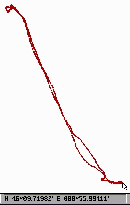
I have a Garmin Pilot III. Yesterday I have used them on the route LFSB - LSZL - LFSB. My
Garmin have made this record: [Image]
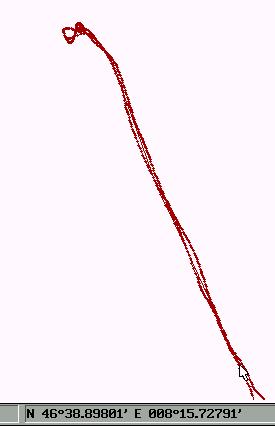
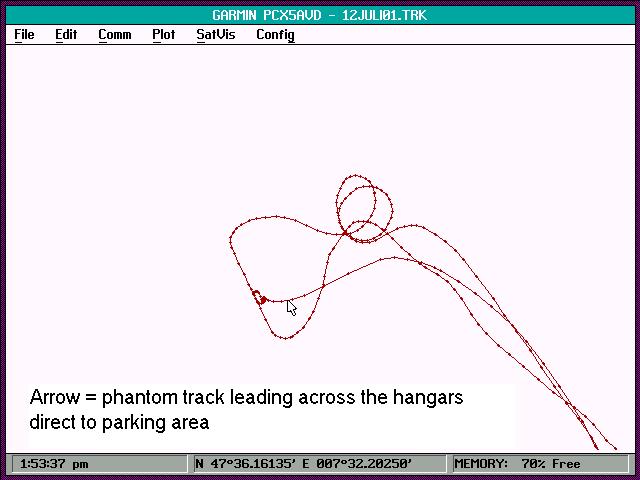
Enlargement of the route show:[Image] at N 46°38.92747 E
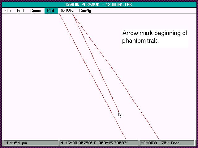
8°15.78894 appear a new phantom track and go his own way till the parking at Basle: [Image] Can you
explained this?
Sincerely
Feliks Plaszczyk
-----------------------------------------------
Thank you for contacting Garmin.
It appears that
you downloaded both the saved route and the active route.
When a route is save the GPS selects the best 30 waypoints.
That is why one route is shorter than the other and is slightly
different.
I recommend deleting the saved route and down loading the
log since it will be more accurate.
Thank you and best Regards,
Frank Brzozowski
Product
Support Specialist
GARMIN International
1200 E. 151st Street
Olathe, KS 66062 USA
http://www.garmin.com/
Tel.(800)
800-1020
(913)397-8200
Fax.(913)397-0836
The right explanation is: the PilotIII save the simulation trip and real trip in the same
TRK file. On the plot is no difference; only the text makes it possible to distinguish them.
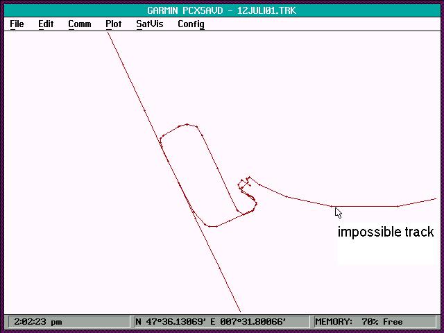
The track Log must be deleted before departure, to avoid fantoms tracks.
Simulation one day before the flight:
T
N4644.14829 E00812.20921 11-JUL-01 19:59:08 -9999
T
N4642.85423 E00813.10319 11-JUL-01 19:59:51 -9999
T
N4639.29665 E00815.53472 11-JUL-01 20:01:49 -9999
T
N4638.93472 E00815.78159 11-JUL-01 20:02:01 -9999
The real fligth:
H LATITUDE
LONGITUDE DATE
TIME ALT
;track
T
N4736.18761 E00731.47376 12-JUL-01 09:55:48 -9999
T N4736.20097 E00731.44141 12-JUL-01
10:08:04 -9999 |